Monday 12th September
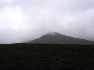
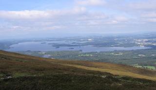
It was a much longer walk today, over challenging terrain and changing weather conditions. I started off from Kate Kearney's Cottage, a tourist-haven cum pub/restaurant at the foot of the Gap of Dunloe. Walking up the road towards the Gap I veered off to the right up a very good path that zigzagged up the hillside revealing more of the spectacular scenery with every turn. When I reached the top of the ridge the view across the MacGillycuddy's Reeks could be seen plainly with Carrauntoohil standing proud at the end, but it didn't take long for the clouds to obliterate Carrauntoohil with the rest of the ridge quickly following suit; it was going to be one of those days!
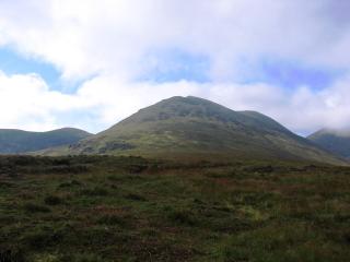
With all trace of a path gone I made my way across the boggy plain to the foot of Cnoc an Bháca, jumping across the wide bogs as I went. Just as I began the ascent I realised I had lost my sunglasses, which were in my pocket (the sun had disappeared behind the clouds!).Despondentlyy I made my way back to the bogs remembering my first day in the Lake District three years ago when I lost my glasses onLoughriggg. When a search failed to locate them I dejectedly made my way back to Cnoc an Bháca until I suddenly came across them lying in the grass. Unbelievable that I hadn't seen them when going back to the bog! With great relief I made my way back towards Cnoc an Bháca as the clouds lifted in front of me. Everyone was happy!
Instead of going straight up to the top I contoured the eastern slopes to make for Cnoc na dTarbh. With hindsight I wish I'd missed this out; it's not a very big hill but I had to put a considerable amount of effort into getting to it and returning to Cnoc an Bháca. I was really weary from my exertion, probably due to not eating enough for such a strenuous walk.

Feeling better after eating a small snickers bar I headed off along the main ridge past a dip and up the steep rocky ridge up to me first 3,000 footer of Ireland, Cruach Mhór. Surveying my surroundings in the bright sunshine I had my lunch and prepared for the most difficult part of the ridge.
Traversing the rocky ridge I made my way across to The Big Gun scrambling around and over large robstacles onleson the way. Keeping as near the top of the ridge as I dared I made the summit and preparedapred for the next bit. Descending to a col I then began the ascent along the narrow rocky ridge all the way up to Cnoc na Peiste, plunging into the cloud that had been coming up from the south. I tried to stay on the top or at least visit it frequently but eventually I had to abandon it in favour of the easier path that followed to the left. It was still an exciting ridge, almost an edge, and was disappointed when the summit emerged through the clouds.
The difficult section now over I was at the highest point of the walk with a relatively easy
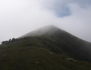
grassy ridge walk ahead of me. Since that would have been too easy, even with the clouds obstructing any views, the wind picked up necessitating the donning of my cagoul for the remainder of the walk. Walking along the ridge I passed over Maolán Buí and Cnoc an Chuillinn before descending steeply to a col with a rather rather non-descript grassy mound ahead of me (Cnoc na Toinne). Following a path that rose along the southern flanks I reached what I assume was the summit, but since there was nothing to be seen, being in the clouds, I have not way of knowing! With the last hill of the day behind me I descended the narrow grassy ridge down to the foot of Carrauntoohil and the head of the Devil's Ladder.
Leaving Carrauntoohil for another day I began the arduous descent down the Devil's Ladder to Hag's Glen through the badly eroded top end and down the scree slope to the valley floor.
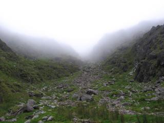
After all I'd heard I was expecting worse, but except for the initial bit at the top, which is very bad, the scree was pretty much standard fare and once omovable movale stuff I was skipping and jumping down with carefree abandon. Following the clear track beside the Gladdagh River I made my way to the road-end on the eastern side of the river. There now lay ahead of me a couple of horoadof raod walking as I made my way back to Kate Kearney's Cottage. A lift by a fellow walker after I had already walked 2/3 of the wayalleviatedeviated some of the tedium and hastened the end of what was becoming a very long walk. More tomorrow!
 Today was a wash out. I drove over to the Dingle Peninsula with varying degrees of rain all the way. In Dingle I decided to head up to the Connor Pass and see what the weather was like. It was raining and cloudy. But because I can't resist doing a walk I headed westwards over Beenabrack along a grassy, boggy ridge up to Ballysitteragh. And then after lunch I walked all the way back. It rained heavily and the wind blew strongly almost all the way. I got soaked! Just two hours walking was enough to put me off for the rest of the day!
 [This picture of Ballysitteragh was taken the following day. I know, that's cheating.]
 Today was a wash out. I drove over to the Dingle Peninsula with varying degrees of rain all the way. In Dingle I decided to head up to the Connor Pass and see what the weather was like. It was raining and cloudy. But because I can't resist doing a walk I headed westwards over Beenabrack along a grassy, boggy ridge up to Ballysitteragh. And then after lunch I walked all the way back. It rained heavily and the wind blew strongly almost all the way. I got soaked! Just two hours walking was enough to put me off for the rest of the day!
 [This picture of Ballysitteragh was taken the following day. I know, that's cheating.]


